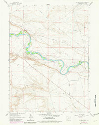
1963 Map of Mc Cullen Bluff
USGS Topo · Published 1981About this map
The Green River carves a striking path through the high desert of Sweetwater County, creating a riparian corridor within the Seedskadee National Wildlife Refuge. The map captures the river's dramatic meander at Horseshoe Bend, where the water is flanked by the steep elevations of Mc Cullen Bluff to the north and the expansive Dodge Rim to the south. This area serves as a critical junction of natural hydrology and early agricultural infrastructure, as seen in the Hamp Ditch No 1, which diverted water from the main stem to support local needs. Transport through this arid landscape is defined by the Farson Cutoff Road and various interconnected trails, while seasonal drainages like Fourmile Gulch and Shute Creek highlight the drainage patterns that have shaped the surrounding plateaus.
Find a feature on this map
11 named features on this map. Tap any name to fly to it.
Don’t see what you’re looking for? This feature index may not catch every label — zoom into the map to look around manually.
Map Details
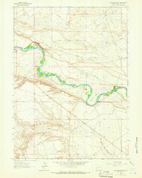
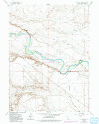
Editions of this 1963 Mc Cullen Bluff Map
3 editions found
Other maps of this area

1954 · Ogden
USGS Topo · 1:250,000

1954 · Rock Springs
USGS Topo · 1:250,000

1955 · Preston
USGS Topo · 1:250,000

1955 · Lander
USGS Topo · 1:250,000

1958 · Lander
USGS Topo · 1:250,000

1958 · Ogden
USGS Topo · 1:250,000

1958 · Rock Springs
USGS Topo · 1:250,000

1958 · Preston
USGS Topo · 1:250,000

1960 · Ogden
USGS Topo · 1:250,000

1961 · Lander
USGS Topo · 1:250,000