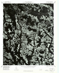
1976 Map of Mc Donald
USGS Topo · Published 1978About this map
Mc Donald and the surrounding rural landscapes of Robeson County are captured in this mid-1970s orthophotoquad, which uses aerial photography rather than traditional topographic lines to show land use. The image reveals a complex patchwork of cultivated fields and dense woodlots characteristic of the Coastal Plain's agricultural heritage. Small settlements like Raynham and Elrod appear as clusters of development amidst the dominant pattern of farm plots and drainage ways. This particular format provides a rare, literal view of the vegetation and cleared acreage as it existed during the bicentennial year, offering a clear record of the rural infrastructure and road networks that connected these small North Carolina communities before late-century expansion.
Find a feature on this map
3 named features on this map. Tap any name to fly to it.
Don’t see what you’re looking for? This feature index may not catch every label — zoom into the map to look around manually.
Map Details
Editions of this 1976 Mc Donald Map
This is the sole edition of this map. No revisions or reprints were ever made.
Other maps of this area

1943 · Pages Mill
USGS Topo · 1:62,500

1953 · Florence
USGS Topo · 1:250,000

1954 · Florence
USGS Topo · 1:250,000

1960 · Dillon East
USGS Topo · 1:24,000

1962 · Fairmont
USGS Topo · 1:24,000

1962 · Gaddysville
USGS Topo · 1:24,000

1962 · Fair Bluff
USGS Topo · 1:62,500

1972 · Northwest Lumberton
USGS Topo · 1:24,000

1972 · Southwest Lumberton
USGS Topo · 1:24,000

1972 · Pembroke
USGS Topo · 1:24,000