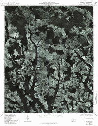
1981 Map of Mc Donald
USGS Topo · Published 1985About this map
Mc Donald and the surrounding lowland drainages of Robeson County are captured here through high-altitude aerial photography. This orthophotoquad reveals the intricate patchwork of agricultural clearings and dense wooded wetlands characteristic of the region in the early 1980s. The landscape is defined by a series of distinct hydrologic features, including the meandering path of the Lumber River and the broad, dark reaches of Ashpole Swamp and Back Swamp. Unlike traditional line maps, this imagery provides a direct look at the field boundaries and farmsteads near Raynham and the rail-aligned settlement of Elrod, showing exactly how these rural communities integrated with the natural drainages of Aaron Swamp and Horse Swamp.
Find a feature on this map
8 named features on this map. Tap any name to fly to it.
Don’t see what you’re looking for? This feature index may not catch every label — zoom into the map to look around manually.
Map Details
Editions of this 1981 Mc Donald Map
This is the sole edition of this map. No revisions or reprints were ever made.
Other maps of this area

1943 · Pages Mill
USGS Topo · 1:62,500

1953 · Florence
USGS Topo · 1:250,000

1954 · Florence
USGS Topo · 1:250,000

1960 · Dillon East
USGS Topo · 1:24,000

1962 · Fairmont
USGS Topo · 1:24,000

1962 · Gaddysville
USGS Topo · 1:24,000

1962 · Fair Bluff
USGS Topo · 1:62,500

1972 · Northwest Lumberton
USGS Topo · 1:24,000

1972 · Southwest Lumberton
USGS Topo · 1:24,000

1972 · Pembroke
USGS Topo · 1:24,000