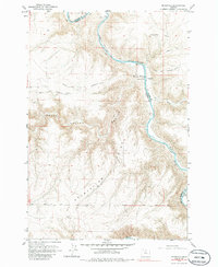
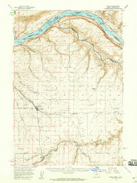
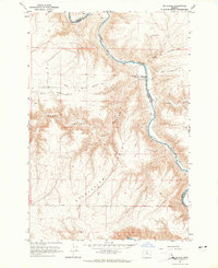
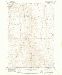
1964 Map of Mc Donald
USGS Topo · Published 1986About this map
The John Day River carves a deep path through the plateau of Sherman and Gilliam Counties, marking a critical corridor for early western migration. Along the river’s edge, the settlement of McDonald serves as a focal point near the Ford and a Gaging Station, while the Old Oregon Trail Monument stands as a permanent marker of the historic path. The map traces the Oregon Trail and the Barlow Cutoff, showing how these wagon routes negotiated the difficult terrain of Grass Valley Canyon. To the south, the curious label Starvation sits near the Base Line, hinting at the hard-scrabble reality of early homesteading in this arid landscape. The area is defined by sharp elevation changes, with numerous Jeep Trails and a Landing Strip providing modern access to remote ranching and grazing lands.
Find a feature on this map
22 named features on this map. Tap any name to fly to it.
Don’t see what you’re looking for? This feature index may not catch every label — zoom into the map to look around manually.
Map Details
Editions of this 1964 Mc Donald Map
2 editions found
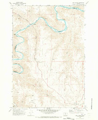
Other maps of this area

1916 · Arlington
USGS Topo · 1:125,000

1916 · Condon
USGS Topo · 1:125,000

1953 · The Dalles
USGS Topo · 1:250,000

1956 · The Dalles
USGS Topo · 1:250,000

1957 · The Dalles
USGS Topo · 1:250,000
1957 · Wasco
USGS Topo · 1:62,500
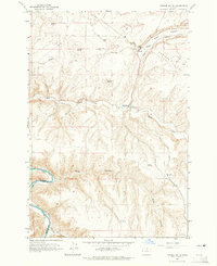
1964 · Turner Butte
USGS Topo · 1:24,000
1964 · Mc Donald
USGS Topo · 1:24,000
1970 · Devils Backbone
USGS Topo · 1:24,000
1970 · Esau Canyon
USGS Topo · 1:24,000