
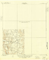
1931 Map of Mc Gregor
USGS Topo · Published 1931About this map
Eagle Springs and the surrounding rural communities of central Texas are documented here following surveys conducted in the mid-1920s. This landscape is defined by its small-scale social infrastructure, where numerous country schools like Haunted Hill Sch and Walker Harris Sch served a distributed population of farming families. The map captures the distinct cultural heritage of the region through its religious landmarks, notably the German Methodist Ch and German Lutheran Ch, indicating the ethnic settlement patterns common to this part of the state during the early 20th century.
Find a feature on this map
24 named features on this map. Tap any name to fly to it.
Don’t see what you’re looking for? This feature index may not catch every label — zoom into the map to look around manually.
Map Details
Editions of this 1931 Mc Gregor Map
2 editions found
Other maps of this area

1888 · Meridian
USGS Topo · 1:125,000

1892 · Temple
USGS Topo · 1:125,000

1892 · Waco
USGS Topo · 1:125,000

1894 · Meridian
USGS Topo · 1:125,000

1894 · Gatesville
USGS Topo · 1:125,000

1920 · Waco
USGS Topo · 1:125,000

1924 · Waco 4-c
USGS Topo · 1:48,000

1924 · Waco 3-d
USGS Topo · 1:48,000

1924 · Gatesville 4-a
USGS Topo · 1:48,000

1924 · Temple 2-C
USGS Topo · 1:48,000