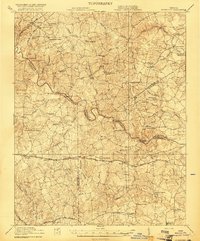
1921 Map of Mc Kenney
USGS Topo · Published 1921About this map
The Nottoway River carves a winding path through this corner of Southside Virginia, serving as a natural boundary between several counties including Dinwiddie, Sussex, and Greensville. The landscape in the early 1920s is defined by a dense network of country schools and churches that anchored rural life, such as the Brummels School, Sappony School, and Big Bethel Church. Transportation in this era relied on a mix of river crossings like Lazottes Ford and Long Bridge, alongside the critical rail corridors of the Seaboard Air Line Ry and the Virginian railroad.
Find a feature on this map
68 named features on this map. Tap any name to fly to it.
Don’t see what you’re looking for? This feature index may not catch every label — zoom into the map to look around manually.
Map Details
Editions of this 1921 Mc Kenney Map
2 editions found

Other maps of this area

1894 · Petersburg
USGS Topo · 1:62,500

1897 · Amelia
USGS Topo · 1:125,000

1918 · Lawrenceville
USGS Topo · 1:62,500

1919 · Jarratt
USGS Topo · 1:62,500

1919 · Mc Kenney
USGS Topo · 1:48,000

1919 · White Plains
USGS Topo · 1:48,000

1919 · Emporia
USGS Topo · 1:62,500

1919 · Arringdale
USGS Topo · 1:48,000

1920 · Lawrenceville
USGS Topo · 1:48,000

1920 · White Plains
USGS Topo · 1:62,500