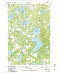
1982 Map of Mc Kenzie Lake
USGS Topo · Published 1983About this map
Glacial kettle lakes and dense pine barrens define this northern Wisconsin landscape along the border of Burnett and Washburn counties. The interconnected waters of McKenzie Lake, Middle McKenzie Lake, and Lower McKenzie Lake dominate the eastern half of the sheet, while smaller basins like Rooney Lake and Nicaboyne Lake dot the western woods. Cultural landmarks of the early 1980s include the Sacred Hearts church and Sacred Hearts Cem near Crescent Lake, as well as the Townhall in the center of Scott.
Find a feature on this map
58 named features on this map. Tap any name to fly to it.
Don’t see what you’re looking for? This feature index may not catch every label — zoom into the map to look around manually.
Map Details
Editions of this 1982 Mc Kenzie Lake Map
This is the sole edition of this map. No revisions or reprints were ever made.
Other maps of this area

1947 · Minong
USGS Topo · 1:48,000

1948 · Spooner
USGS Topo · 1:48,000

1949 · Hertel
USGS Topo · 1:48,000

1949 · Minong
USGS Topo · 1:48,000

1949 · Webb Lake
USGS Topo · 1:48,000

1949 · Spooner
USGS Topo · 1:48,000

1953 · Ashland
USGS Topo · 1:250,000

1953 · Duluth
USGS Topo · 1:250,000

1953 · Rice Lake
USGS Topo · 1:250,000

1953 · Stillwater
USGS Topo · 1:250,000