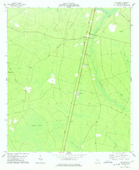
1978 Map of Mc Kinnon
USGS Topo · Published 1978About this map
The Seaboard Coast Line railroad dictates the settlement pattern of this rural Wayne County landscape, with a string of small communities clustered along the rail corridor. In the late 1970s, Broadhurst, McKinnon, and O Neal served as localized hubs for a region characterized by extensive wetlands and drainage systems. The hydrologic network is dominated by the meandering Penholoway Creek and its tributary Little Penholoway Creek, which feed into the broad expanse of Cypress Swamp to the east.
Find a feature on this map
24 named features on this map. Tap any name to fly to it.
Don’t see what you’re looking for? This feature index may not catch every label — zoom into the map to look around manually.
Map Details
Editions of this 1978 Mc Kinnon Map
This is the sole edition of this map. No revisions or reprints were ever made.
Other maps of this area

1918 · Jesup
USGS Topo · 1:62,500

1918 · Hortense
USGS Topo · 1:62,500

1943 · Jesup
USGS Topo · 1:62,500

1944 · Hortense
USGS Topo · 1:62,500

1946 · Brunswick
USGS Topo · 1:250,000

1948 · Brunswick
USGS Topo · 1:250,000

1953 · Waycross
USGS Topo · 1:250,000

1956 · Brunswick
USGS Topo · 1:250,000

1958 · Waycross
USGS Topo · 1:250,000

1961 · Brunswick
USGS Topo · 1:250,000