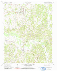
1966 Map of Mc Lemoresville
USGS Topo · Published 1991About this map
McLemoresville serves as the primary hub of this Carroll County landscape, situated where an Old RR Grade crosses through the local drainage network. The terrain is defined by the winding course of the Rutherford Fork Obion River, which gathers numerous tributaries including White Creek, Mill Branch, and Steep Bank Branch. This mid-century survey reveals a highly distributed rural community anchored by small churches and schools, such as Westview Sch, Obion Chapel, and Carter Chapel.
Find a feature on this map
32 named features on this map. Tap any name to fly to it.
Don’t see what you’re looking for? This feature index may not catch every label — zoom into the map to look around manually.
Map Details
Editions of this 1966 Mc Lemoresville Map
2 editions found
Other maps of this area

1936 · Clarksburg
USGS Topo · 1:24,000

1936 · Center Ridge
USGS Topo · 1:24,000

1950 · Palmer Shelter
USGS Topo · 1:24,000

1950 · Clarksburg
USGS Topo · 1:24,000

1955 · Huntingdon
USGS Topo · 1:24,000

1956 · Dyersburg
USGS Topo · 1:250,000

1956 · Blytheville
USGS Topo · 1:250,000

1959 · Blytheville
USGS Topo · 1:250,000

1966 · Spring Creek
USGS Topo · 1:24,000

1966 · Mc Lemoresville
USGS Topo · 1:24,000