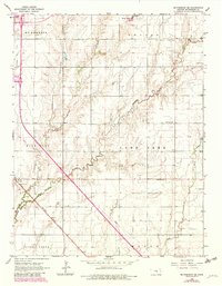
1965 Map of Mc Pherson SE
USGS Topo · Published 1983About this map
Turkey Creek and Running Turkey Creek wind through the agricultural landscape south of McPherson, defining the drainage patterns of several rural townships including King City and Lone Tree. This mid-century survey illustrates a region where farming and energy extraction coexist, most notably within the Empire Oil Field in the northeast and near the small settlement of Elyria. The landscape is dotted with the critical infrastructure of rural community life, featuring several country burial grounds such as Dunkard Cem and Lone Tree Cem.
Find a feature on this map
22 named features on this map. Tap any name to fly to it.
Don’t see what you’re looking for? This feature index may not catch every label — zoom into the map to look around manually.
Map Details
Editions of this 1965 Mc Pherson SE Map
4 editions found
Other maps of this area

1889 · Newton
USGS Topo · 1:125,000

1891 · Hutchinson
USGS Topo · 1:125,000

1893 · Hutchinson
USGS Topo · 1:125,000

1894 · Newton
USGS Topo · 1:125,000

1955 · Hutchinson
USGS Topo · 1:250,000

1959 · Hutchinson
USGS Topo · 1:250,000

1965 · Mc Pherson South
USGS Topo · 1:24,000

1965 · Galva
USGS Topo · 1:24,000

1965 · Halstead NW
USGS Topo · 1:24,000
1965 · Mc Pherson SE
USGS Topo · 1:24,000