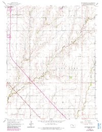
1965 Map of Mc Pherson SE
USGS Topo · Published 1985About this map
Turkey Creek and Running Turkey Creek wind through the agricultural landscape of McPherson County in the mid-1960s, a region where rural life and energy production overlap. The settlement of Elyria anchors the western edge, adjacent to the Missouri Pacific railroad line that cuts diagonally across the prairie. This area is characterized by a dense network of traditional communal landmarks, including several rural burial grounds such as Empire Cem, Dunkard Cem, and Lone Tree Cem.
Find a feature on this map
24 named features on this map. Tap any name to fly to it.
Don’t see what you’re looking for? This feature index may not catch every label — zoom into the map to look around manually.
Map Details
Editions of this 1965 Mc Pherson SE Map
4 editions found
Other maps of this area

1889 · Newton
USGS Topo · 1:125,000

1891 · Hutchinson
USGS Topo · 1:125,000

1893 · Hutchinson
USGS Topo · 1:125,000

1894 · Newton
USGS Topo · 1:125,000

1955 · Hutchinson
USGS Topo · 1:250,000

1959 · Hutchinson
USGS Topo · 1:250,000

1965 · Mc Pherson South
USGS Topo · 1:24,000

1965 · Galva
USGS Topo · 1:24,000

1965 · Halstead NW
USGS Topo · 1:24,000
1965 · Mc Pherson SE
USGS Topo · 1:24,000