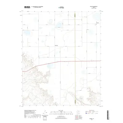
2019 Map of McAdoo
USGS Topo · Published 2019About this map
McAdoo sits atop the Caprock, anchoring this 2019 survey of the High Plains transition in West Texas. The landscape is defined by a grid of agricultural section lines and cattle ranching infrastructure, such as Ranch Rd 28, which contrast with the deeply eroded drainage systems to the south and west. Here, the headwaters of Grape Creek and Gannon Cr carve through the escarpment, creating a broken topography that drops away from the flat cultivated fields above. In the northeast, the McAdoo Cem remains a significant landmark for those tracing local family history in Dickens County. The map also captures the small community of Broadway, positioned along the Crosby and Dickens County line. This 2019 edition provides a clear view of the modern road network, including FM 193 and FM 264, which facilitate the region's agricultural economy while crossing the winding path of Dockum Cr.
Find a feature on this map
34 named features on this map. Tap any name to fly to it.
Don’t see what you’re looking for? This feature index may not catch every label — zoom into the map to look around manually.
Map Details
Editions of this 2019 McAdoo Map
This is the sole edition of this map. No revisions or reprints were ever made.
Other maps of this area

1954 · Lubbock
USGS Topo · 1:250,000

1961 · Bunker Hill
USGS Topo · 1:24,000

1965 · Wake
USGS Topo · 1:24,000

1966 · Crosbyton
USGS Topo · 1:24,000

1966 · Mount Blanco
USGS Topo · 1:24,000

1966 · McAdoo
USGS Topo · 1:24,000

1966 · Collett Springs
USGS Topo · 1:24,000

1967 · Haystack Mountain
USGS Topo · 1:24,000

1968 · Foreman Chapel
USGS Topo · 1:24,000

1968 · Rustler Camp
USGS Topo · 1:24,000