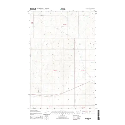
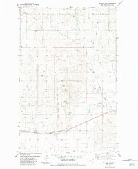
2014 Map of McCabe East
USGS Topo · Published 2014About this map
McCabe and Lanark anchor this agricultural landscape in northeastern Roosevelt County during the early 21st century. The terrain is defined by a dendritic drainage pattern where intermittent streams like W Shotgun Cr and E Shotgun Cr converge into the main channel of Shotgun Cr. To the west, Shell Cr and Clover Cr further dissect the plains, illustrating the water-scarce environment of the Montana high country. The transportation network is built upon a rigid section-line grid, dominated by thoroughfares such as McCabe Rd and Star Coulee Rd, which intersect the primary corridor of Us-2. This U.S. Department of the Interior survey provides a clear view of the rural township structure and the distribution of localized water features including Snake Cr, reflecting the persistent spatial organization of Big Sky country's ranching and farming lands.
Find a feature on this map
19 named features on this map. Tap any name to fly to it.
Don’t see what you’re looking for? This feature index may not catch every label — zoom into the map to look around manually.
Map Details
Editions of this 2014 McCabe East Map
This is the sole edition of this map. No revisions or reprints were ever made.
Other maps of this area

1954 · Wolf Point
USGS Topo · 1:250,000

1958 · Wolf Point
USGS Topo · 1:250,000

1969 · Cedar Coulee
USGS Topo · 1:24,000

1969 · Three Buttes
USGS Topo · 1:24,000

1969 · Bainville SW
USGS Topo · 1:24,000

1982 · Culbertson
USGS Topo · 1:100,000
1983 · Bainville
USGS Topo · 1:24,000
1983 · Mc Cabe West
USGS Topo · 1:24,000
1983 · Brush Mountain SW
USGS Topo · 1:24,000
1983 · Mc Cabe East
USGS Topo · 1:24,000