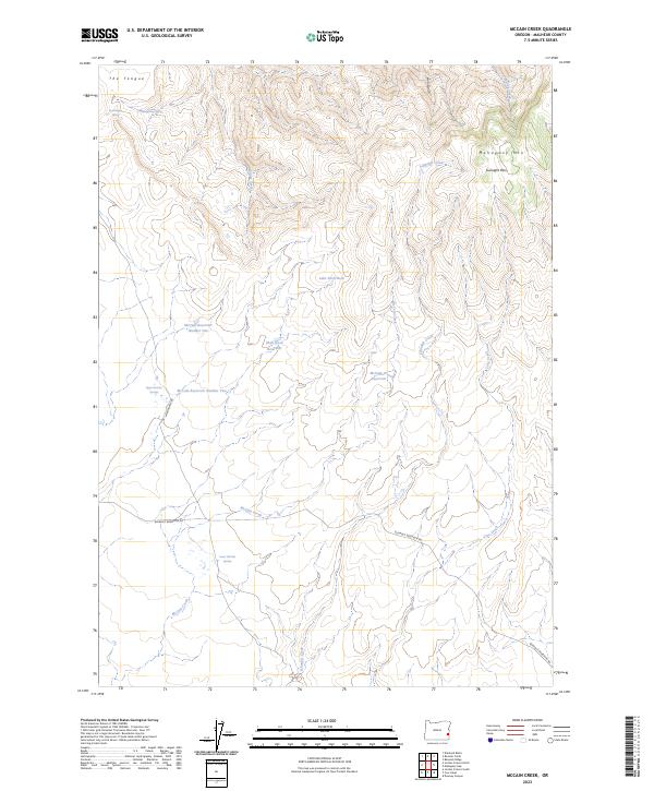
2023 Map of McCain Creek
USGS Topo · Published 2023About this map
Mahogany Mountain and the high ridges of Gunsight Pass anchor this remote corner of Malheur County, where the landscape is defined by its water management and sparse desert springs. The 2023 terrain reveals an intricate network of irrigation and storage, including McCain Reservoir Number One, McCain Reservoir Number Two, and the smaller Shell Rock Reservoir. These features, alongside named water sources like Moonshine Spring and Grasshopper Spring, highlight the essential infrastructure required for life and livestock in this arid environment. Navigation through the complex topography of The Tongue and Lake Shell Rock is facilitated by local routes such as Mahogany Rd and Blowout Reservoir Rd. This modern survey provides a detailed view of the watershed as it exists today, tracing the flow of McCain Creek and Cove Creek through the high-desert canyons.
Find a feature on this map
26 named features on this map. Tap any name to fly to it.
Don’t see what you’re looking for? This feature index may not catch every label — zoom into the map to look around manually.
Map Details
Editions of this 2023 McCain Creek Map
This is the sole edition of this map. No revisions or reprints were ever made.
Other maps of this area

1955 · Boise
USGS Topo · 1:250,000

1958 · Boise
USGS Topo · 1:250,000

1962 · Boise
USGS Topo · 1:250,000

1967 · Diamond Butte
USGS Topo · 1:24,000
1967 · Bannock Ridge
USGS Topo · 1:24,000

1967 · Rooster Comb
USGS Topo · 1:24,000
1969 · Mahogany Gap
USGS Topo · 1:24,000

1969 · Jordan Craters South
USGS Topo · 1:24,000

1969 · Mc Cain Creek
USGS Topo · 1:24,000

1969 · Jordan Craters North
USGS Topo · 1:24,000