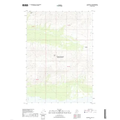
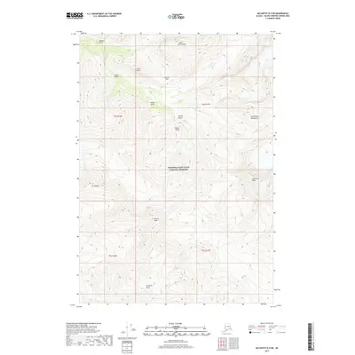
2017 Map of McCarthy A-4 NW
USGS Topo · Published 2017About this map
Wrangell-Saint Elias National Preserve encompasses most of this landscape within the Saint Elias Mountains, where the elevation changes are dramatic. The southern portion of the quadrangle is defined by the braided path of the Chitina River, a significant waterway fed by glacial runoff from the surrounding peaks. Centrally, the Maccoll Ridge serves as a prominent topographical divide between the drainages of Young Cr and smaller tributaries like Sheep Cr. In the far northwest corner, Calamity Gulch cuts into the high terrain, marking a distinct drainage point. The map illustrates a transitional zone where the high-altitude ice and rock of the Saint Elias range meet the lower river valleys, with the Public Land Survey System grid lines of t7s r16e and t8s r17e overlaid across this remote wilderness.
Find a feature on this map
11 named features on this map. Tap any name to fly to it.
Don’t see what you’re looking for? This feature index may not catch every label — zoom into the map to look around manually.
Map Details
Editions of this 2017 McCarthy A-4 NW Map
This is the sole edition of this map. No revisions or reprints were ever made.
Other maps of this area

1951 · McCarthy
USGS Topo · 1:250,000

1959 · McCarthy A-4
USGS Topo · 1:63,360

1959 · McCarthy B-5
USGS Topo · 1:63,360

1959 · McCarthy B-4
USGS Topo · 1:63,360

1959 · McCarthy A-5
USGS Topo · 1:63,360

1960 · McCarthy
USGS Topo · 1:250,000
1994 · McCarthy A-4
USGS Topo · 1:63,360
1994 · McCarthy A-5
USGS Topo · 1:63,360
1994 · McCarthy B-4
USGS Topo · 1:63,360
2017 · McCarthy B-4 SW
USGS Topo · 1:25,000