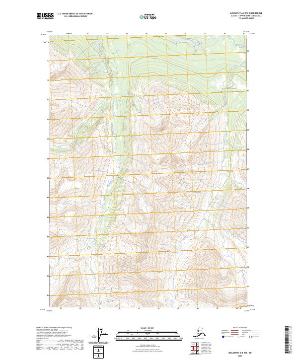
2023 Map of McCarthy A-8 NW
USGS Topo · Published 2023About this map
The northern reaches of Wrangell-Saint Elias National Park and the protected Wrangell-St. Elias Wilderness dominate this Alaskan landscape. High-altitude drainages define the area's movement, with the Hanagita River flowing across the northern border and the south-flowing Sanguina Creek and Lake Creek cutting through the interior. This is a region defined by extreme elevation changes and roadless terrain, where the hydrography provides the only navigable landmarks across the landscape. The map captures the remote character of the Copper River Census Area at the start of the 2020s, showing a preserve largely untouched by infrastructure or human settlement.
Find a feature on this map
9 named features on this map. Tap any name to fly to it.
Don’t see what you’re looking for? This feature index may not catch every label — zoom into the map to look around manually.
Map Details
Editions of this 2023 McCarthy A-8 NW Map
This is the sole edition of this map. No revisions or reprints were ever made.
Other maps of this area

1950 · McCarthy A-8
USGS Topo · 1:63,360

1951 · McCarthy
USGS Topo · 1:250,000

1951 · Valdez B-1
USGS Topo · 1:63,360

1951 · Valdez A-1
USGS Topo · 1:63,360

1951 · McCarthy B-8
USGS Topo · 1:63,360

1952 · Valdez
USGS Topo · 1:250,000

1960 · McCarthy
USGS Topo · 1:250,000

1960 · Valdez
USGS Topo · 1:250,000

1995 · McCarthy B-8
USGS Topo · 1:63,360
1995 · Valdez B-1
USGS Topo · 1:63,360