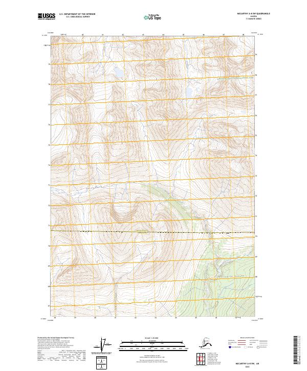
2023 Map of McCarthy A-8 SW
USGS Topo · Published 2023About this map
Wrangell-Saint Elias National Park encompasses much of this interior Alaskan landscape, which transitioned between Copper River Co and Chugach Co jurisdictions. The terrain is defined by dramatic elevation changes, where high ridges overlook deep-set watercourses like Twelvemile Canyon and Harrys Gulch. This 2023 survey illustrates the glacial and fluvial drainage patterns common to the region, most notably the winding path of the North Fork Bremner River in the southeast corner. The vast protected area within the Wrangell-St. Elias Wilderness remains largely untouched by development, focusing on natural features such as Sangaina Creek and Lake Creek. These features underscore the extreme isolation of this mountainous territory, where steep contours rise from valley floors to high alpine peaks without the presence of modern road infrastructure.
Find a feature on this map
13 named features on this map. Tap any name to fly to it.
Don’t see what you’re looking for? This feature index may not catch every label — zoom into the map to look around manually.
Map Details
Editions of this 2023 McCarthy A-8 SW Map
This is the sole edition of this map. No revisions or reprints were ever made.
Other maps of this area

1948 · Cordova
USGS Topo · 1:250,000

1950 · McCarthy A-8
USGS Topo · 1:63,360

1950 · Bering Glacier
USGS Topo · 1:250,000

1951 · McCarthy
USGS Topo · 1:250,000

1951 · Bering Glacier
USGS Topo · 1:250,000

1951 · Cordova
USGS Topo · 1:250,000

1951 · Valdez A-1
USGS Topo · 1:63,360

1952 · Valdez
USGS Topo · 1:250,000

1959 · Cordova D-1
USGS Topo · 1:63,360

1959 · Bering Glacier
USGS Topo · 1:250,000