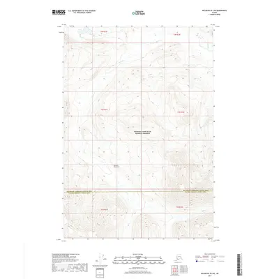
2017 Map of McCarthy D-2 NE
USGS Topo · Published 2017About this map
The Nutzotin Mountains dominate this high-altitude landscape, which is largely encompassed by the Wrangell-Saint Elias National Preserve. The terrain is defined by extreme relief and glacial drainage patterns, with the headwaters of Ophir Cr and Beaver Cr carving deep valleys through the mountain range. This 2017 survey captures a remote wilderness area along the administrative boundary between the Southeast Fairbanks Census Area and the Valdez-Cordova Census Area. The absence of roads or established settlements underscores the primitive nature of this environment, where land use is primarily governed by federal conservation status. Public land surveyors have marked the region into townships and ranges, including t2n r21e and t2n r22e, providing a structural grid over the otherwise trackless peaks.
Find a feature on this map
11 named features on this map. Tap any name to fly to it.
Don’t see what you’re looking for? This feature index may not catch every label — zoom into the map to look around manually.
Map Details
Editions of this 2017 McCarthy D-2 NE Map
This is the sole edition of this map. No revisions or reprints were ever made.
Other maps of this area

1950 · Nabesna
USGS Topo · 1:250,000

1951 · McCarthy
USGS Topo · 1:250,000

1951 · Nabesna
USGS Topo · 1:250,000

1959 · McCarthy D-1
USGS Topo · 1:63,360

1959 · McCarthy D-2
USGS Topo · 1:63,360

1959 · Nabesna A-1
USGS Topo · 1:63,360

1960 · Nabesna A-2
USGS Topo · 1:63,360

1960 · Nabesna
USGS Topo · 1:250,000

1960 · McCarthy
USGS Topo · 1:250,000
2016 · Nabesna A-1 SW
USGS Topo · 1:25,000