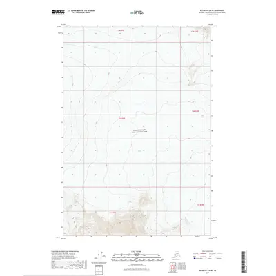
2017 Map of McCarthy D-8 NE
USGS Topo · Published 2017About this map
Wrangell-Saint Elias National Park encompasses the entire landscape of this 2017 survey, revealing an ice-dominated environment within the Alaska wilderness. The terrain is defined by massive ice flows, most notably the Copper Glacier in the northern reaches and the Nabesna Glacier which extends through the central and southern portions of the quadrangle. In the far southwest corner, the Kluvesna Glacier emerges, illustrating the complex glacial drainage patterns of the high-altitude interior. This topographic study, produced by the U.S. Geological Survey, focuses exclusively on the natural physical geography of the region. There are no roads, settlements, or man-made structures indicated, making this an essential record of the state's preserved wildlands and glacial extent during the early twenty-first century.
Find a feature on this map
13 named features on this map. Tap any name to fly to it.
Don’t see what you’re looking for? This feature index may not catch every label — zoom into the map to look around manually.
Map Details
Editions of this 2017 McCarthy D-8 NE Map
This is the sole edition of this map. No revisions or reprints were ever made.
Other maps of this area

1950 · Nabesna
USGS Topo · 1:250,000

1951 · McCarthy
USGS Topo · 1:250,000

1951 · Nabesna
USGS Topo · 1:250,000

1959 · Nabesna A-6
USGS Topo · 1:63,360

1959 · McCarthy D-7
USGS Topo · 1:63,360

1960 · McCarthy D-8
USGS Topo · 1:63,360

1960 · Nabesna
USGS Topo · 1:250,000

1960 · McCarthy
USGS Topo · 1:250,000
2016 · Nabesna A-6 SE
USGS Topo · 1:25,000
2016 · Nabesna A-6 SW
USGS Topo · 1:25,000