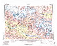
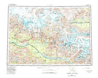
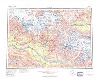
1960 Map of McCarthy
USGS Topo · Published 1994About this map
The confluence of the Nizina River and the Chitina River anchors this massive survey of the Copper River region during a period of expanding federal conservation. The map documents the vast Wrangell-St Elias National Park and Preserve, an area defined by the convergence of the Wrangell Mountains, St Elias Mountains, and the Chugach Mountains. Small outposts like McCarthy, May Creek, and Chitina represent the sparse human footprint in a landscape dominated by massive ice fields, including the Barnard Glacier, Klutlan Glacier, and Nabesna Glacier. Rising above these glacial systems are some of the continent's highest peaks, such as Mount Blackburn, Mount Bona, and Mount Churchill. The eastern margin follows the United States Canada international boundary, where the White River crosses into the Yukon, illustrating the remote and transboundary nature of this northern wilderness.
Find a feature on this map
53 named features on this map. Tap any name to fly to it.
Don’t see what you’re looking for? This feature index may not catch every label — zoom into the map to look around manually.
Map Details
Editions of this 1960 McCarthy Map
7 editions found

Other maps of this area

1948 · Cordova
USGS Topo · 1:250,000

1950 · Nabesna
USGS Topo · 1:250,000

1950 · McCarthy A-8
USGS Topo · 1:63,360

1950 · Bering Glacier
USGS Topo · 1:250,000

1951 · McCarthy
USGS Topo · 1:250,000

1951 · Gulkana
USGS Topo · 1:250,000

1951 · Bering Glacier
USGS Topo · 1:250,000

1951 · Nabesna
USGS Topo · 1:250,000

1951 · Cordova
USGS Topo · 1:250,000

1951 · Mt Saint Elias
USGS Topo · 1:250,000