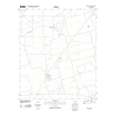
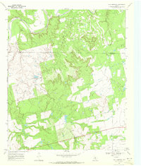
2010 Map of McCaulley
USGS Topo · Published 2010About this map
The settlement of McCaulley anchors this 2010 survey of West Texas, showing a grid of rural county roads that facilitate the local agricultural and industrial landscape. To the north, the presence of Celotex and the Three Rivers Gypsum Incorporated Lake Dam at Plasterco Lake indicates the area's historical and ongoing ties to gypsum processing and mineral extraction. The map reveals an infrastructure supporting both ranching and regional transit, with the Hamlin Municipal Airport and Killion Ranch Airport situated near the intersection of FM 57 and other state routes. In the northwestern corner, Peter Hill rises above the drainage of California Creek, while the presence of the Reynolds settlement and the Old McCaulley Hwy provides clear markers for those tracing property boundaries and legacy transportation routes in Fisher and Jones counties.
Find a feature on this map
42 named features on this map. Tap any name to fly to it.
Don’t see what you’re looking for? This feature index may not catch every label — zoom into the map to look around manually.
Map Details
Editions of this 2010 McCaulley Map
This is the sole edition of this map. No revisions or reprints were ever made.
Other maps of this area

1893 · Roby
USGS Topo · 1:125,000

1931 · Rotan
USGS Topo · 1:62,500

1954 · Big Spring
USGS Topo · 1:250,000

1957 · Noodle
USGS Topo · 1:62,500

1958 · Big Spring
USGS Topo · 1:250,000
1965 · Hamlin NE
USGS Topo · 1:24,000
1965 · Neinda
USGS Topo · 1:24,000
1965 · Hamlin NW
USGS Topo · 1:24,000

1965 · McCaulley
USGS Topo · 1:24,000
1969 · Poke Mountain
USGS Topo · 1:24,000