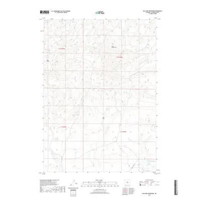
2017 Map of McCleary Reservoir
USGS Topo · Published 2017About this map
Emigrant Trail Rd cuts through the southeastern corner of this Natrona County landscape, following a historic path through a network of seasonal draws and creeks. This 2017 survey shows a terrain defined by high ridges and deep drainage systems like Burnt Wagon Draw and Piño Draw, which collect runoff for livestock and irrigation. Water management is a central theme of the area's development, evidenced by the McCleary Reservoir and Luten Reservoir. These man-made features are crucial for sustaining activity in this arid environment. The map also records distinctive local landmarks such as Horse Heaven, along with various watercourses including Henderson Cr, Austin Cr, and Meadow Cr. The layout of section lines and township boundaries like t32n r85w provides a clear framework for understanding the 21st-century land use and property divisions in this portion of the Wyoming high country.
Find a feature on this map
17 named features on this map. Tap any name to fly to it.
Don’t see what you’re looking for? This feature index may not catch every label — zoom into the map to look around manually.
Map Details
Editions of this 2017 McCleary Reservoir Map
This is the sole edition of this map. No revisions or reprints were ever made.
Other maps of this area

1951 · Pine Mountain SW
USGS Topo · 1:24,000

1951 · Benton Basin SW
USGS Topo · 1:24,000

1951 · Benton Basin
USGS Topo · 1:24,000

1951 · Poison Spider
USGS Topo · 1:24,000

1951 · Benton Basin NE
USGS Topo · 1:24,000

1951 · Mc Cleary Reservoir
USGS Topo · 1:24,000

1955 · Casper
USGS Topo · 1:250,000

1958 · Casper
USGS Topo · 1:250,000

1959 · Eightmile Draw
USGS Topo · 1:24,000

1959 · Horse Creek Springs
USGS Topo · 1:24,000