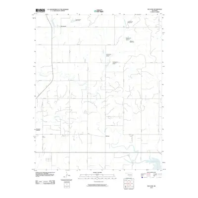
2010 Map of McClure
USGS Topo · Published 2010About this map
Washita River meanders through the central landscape of this Roger Mills County region, defining a terrain shaped by water management and rural agriculture. The northern half of the map is notable for its dense network of small reservoirs and dams, including Quartermaster Site 25 Dam, Quartermaster Creek Site 30 Dam, and Oknoname 039001 Dam. These features, primarily situated along Wild Horse Creek and Quartermaster Creek, illustrate the importance of flood control and water storage for the local farming community.
Find a feature on this map
33 named features on this map. Tap any name to fly to it.
Don’t see what you’re looking for? This feature index may not catch every label — zoom into the map to look around manually.
Map Details
Editions of this 2010 McClure Map
This is the sole edition of this map. No revisions or reprints were ever made.
Other maps of this area

1955 · Clinton
USGS Topo · 1:250,000

1957 · Clinton
USGS Topo · 1:250,000

1957 · Butler
USGS Topo · 1:62,500

1960 · Hammon
USGS Topo · 1:62,500

1961 · Leedey
USGS Topo · 1:62,500

1962 · Aledo
USGS Topo · 1:62,500

1976 · Butler NW
USGS Topo · 1:24,000

1976 · Butler SW
USGS Topo · 1:24,000
1983 · Foss Dam
USGS Topo · 1:24,000
1983 · Butler
USGS Topo · 1:24,000