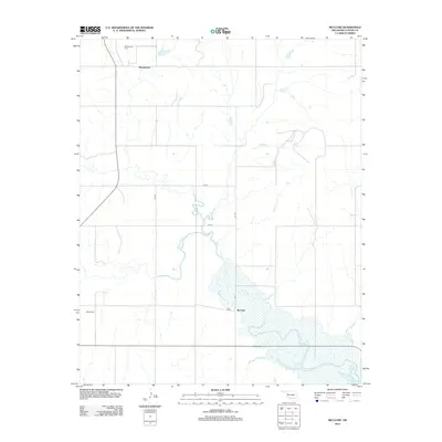
2012 Map of McClure
USGS Topo · Published 2012About this map
The Washita River meanders across this rural landscape, carving a prominent path through the center of the survey. The small settlement of McClure sits along its banks in the southern reaches, while Moorewood anchors the northern portion of the quadrangle. This area of Oklahoma is characterized by its agricultural grid, defined by routes such as N2050 Rd and E0930 Rd, which connect isolated farmsteads and rural landmarks. Local history is anchored by the presence of the Moorewood Cem and Bethel Cem, both serving as significant markers for genealogists and researchers tracking family roots in this river valley region. The terrain transitions from the river's lowlands to the drainage area of Wild Horse Cr, illustrating the typical hydrology of the Great Plains.
Find a feature on this map
13 named features on this map. Tap any name to fly to it.
Don’t see what you’re looking for? This feature index may not catch every label — zoom into the map to look around manually.
Map Details
Editions of this 2012 McClure Map
This is the sole edition of this map. No revisions or reprints were ever made.
Other maps of this area

1955 · Clinton
USGS Topo · 1:250,000

1957 · Clinton
USGS Topo · 1:250,000

1957 · Butler
USGS Topo · 1:62,500

1960 · Hammon
USGS Topo · 1:62,500

1961 · Leedey
USGS Topo · 1:62,500

1962 · Aledo
USGS Topo · 1:62,500

1976 · Butler NW
USGS Topo · 1:24,000

1976 · Butler SW
USGS Topo · 1:24,000
1983 · Foss Dam
USGS Topo · 1:24,000
1983 · Butler
USGS Topo · 1:24,000