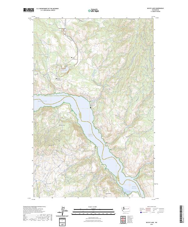
2023 Map of McCoy Lake
USGS Topo · Published 2023About this map
The Spokane River Arm of the Columbia River defines this portion of the Stevens County and Lincoln County border. The map illustrates a landscape shaped by water and high terrain, from the Porcupine Bay inlet in the south to the broad waters of the Lake Roosevelt National Recreation Area. Inland, the geography rises toward Lilienthal Mtn and Boundary Butte, punctuated by small upland valleys like Enterprise Valley. Local roads such as Old Hwy 22-McCoy Lake Rd and BIA Hwy 63 provide access to rural landmarks including McCoy Lake and several distinct community sites. Genealogists will find several notable burial grounds, including the Our Lady of Lourdes Cem, West End Assembly of God Cem, and the Spokane River Presbyterian Cem, which reflect the area's diverse denominational history.
Find a feature on this map
42 named features on this map. Tap any name to fly to it.
Don’t see what you’re looking for? This feature index may not catch every label — zoom into the map to look around manually.
Map Details
Editions of this 2023 McCoy Lake Map
This is the sole edition of this map. No revisions or reprints were ever made.
Other maps of this area

1948 · Hunters
USGS Topo · 1:62,500

1948 · Wilmont Creek
USGS Topo · 1:62,500

1948 · Lincoln
USGS Topo · 1:62,500

1948 · Turtle Lake
USGS Topo · 1:62,500

1950 · Lincoln
USGS Topo · 1:62,500

1950 · Turtle Lake
USGS Topo · 1:62,500

1950 · Wilmont Creek
USGS Topo · 1:62,500

1950 · Hunters
USGS Topo · 1:62,500

1953 · Ritzville
USGS Topo · 1:250,000

1954 · Okanogan
USGS Topo · 1:250,000