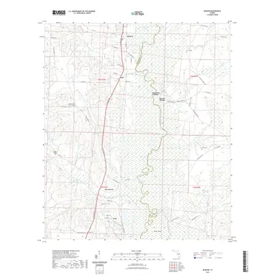
2021 Map of McDavid
USGS Topo · Published 2021About this map
The Escambia River meanders across the eastern Florida panhandle, defining a landscape of low-lying wetlands and springs along the border of Escambia and Santa Rosa counties. Small settlements like McDavid, Bogia, and Pine Barren are concentrated along the north-south corridor of S Century Blvd and the L & N RR. This transportation spine links rural communities that rely on the surrounding water systems, including Cotton Creek and Fletcher Creek.
Find a feature on this map
120 named features on this map. Tap any name to fly to it.
Don’t see what you’re looking for? This feature index may not catch every label — zoom into the map to look around manually.
Map Details
Editions of this 2021 McDavid Map
This is the sole edition of this map. No revisions or reprints were ever made.
Other maps of this area

1920 · Milton
USGS Topo · 1:62,500

1921 · Muscogee
USGS Topo · 1:62,500

1941 · Muscogee
USGS Topo · 1:62,500

1941 · Milton
USGS Topo · 1:62,500

1941 · Century
USGS Topo · 1:62,500

1943 · Muscogee
USGS Topo · 1:62,500

1943 · Century
USGS Topo · 1:62,500

1943 · Milton
USGS Topo · 1:62,500

1943 · Jay
USGS Topo · 1:62,500

1957 · Pensacola
USGS Topo · 1:250,000