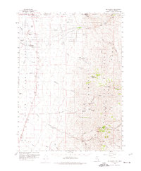
1959 Map of McDermitt
USGS Topo · Published 1974About this map
McDermitt sits at the northern edge of the Nevada-Oregon border, serving as a vital crossroads where the Quinn River begins its course through the high desert. This late-1950s survey captures a landscape defined by the Fort McDermitt Indian Reservation and several significant family-held operations, including the Giacometto Ranch and the Fort McDermitt Ranch Hdqrs. Mining history is deeply etched into the eastern slopes of the Humboldt National Forest, where a cluster of workings like the National Mine, Birthday Mine, and Auto Mine are located near Charleston Hill. The map provides excellent genealogical detail for the area, marking the McDermitt Cem and the small Landing Strip north of town, reflecting the era's reliance on both traditional ranching and modern aerial transit in these remote basins. Drainage patterns are meticulously recorded, from the Eightmile Creek system to the North Fork Little Humboldt River in the southeast corner.
Find a feature on this map
59 named features on this map. Tap any name to fly to it.
Don’t see what you’re looking for? This feature index may not catch every label — zoom into the map to look around manually.
Map Details
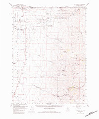
Editions of this 1959 McDermitt Map
3 editions found
Other maps of this area

1882 · Paradise
USGS Topo · 1:250,000

1893 · Paradise
USGS Topo · 1:250,000

1955 · McDermitt
USGS Topo · 1:250,000

1955 · Jordan Valley
USGS Topo · 1:250,000

1957 · Jordan Valley
USGS Topo · 1:250,000

1958 · Jordan Valley
USGS Topo · 1:250,000

1959 · McDermitt
USGS Topo · 1:250,000

1959 · Orovada
USGS Topo · 1:62,500

1959 · McDermitt
USGS Topo · 1:62,500

1959 · Hinkey Summit
USGS Topo · 1:62,500