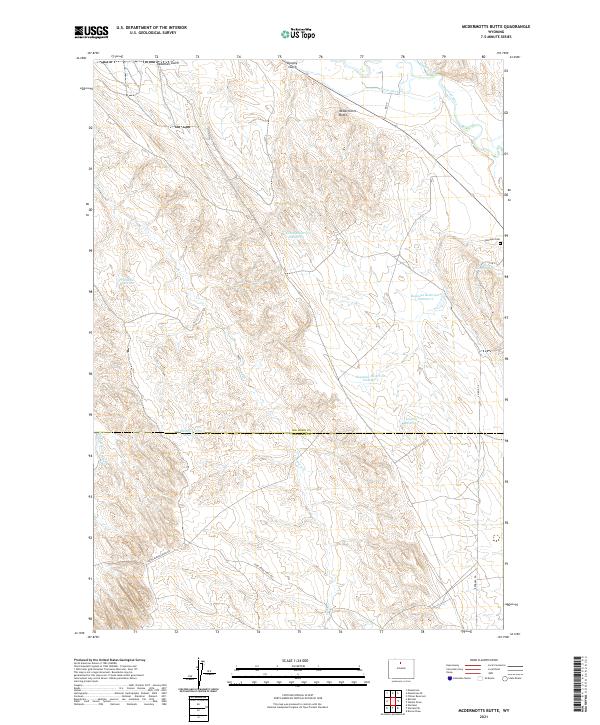
2021 Map of McDermotts Butte
USGS Topo · Published 2021About this map
McDermotts Butte stands as a prominent landmark in this arid stretch of the Bighorn Basin, marking a landscape defined by seasonal water management and early ranching infrastructure. The map details a complex network of reservoirs, including Bonanza Reservoir Number 1, Bonanza Reservoir Number 2, and Bonanza Reservoir Number 3, which support the livestock and agricultural needs of this high-desert environment. These water sources are complemented by historic irrigation efforts such as Avent Ditch and the Upper Hanover Canal.
Find a feature on this map
25 named features on this map. Tap any name to fly to it.
Don’t see what you’re looking for? This feature index may not catch every label — zoom into the map to look around manually.
Map Details
Editions of this 2021 McDermotts Butte Map
This is the sole edition of this map. No revisions or reprints were ever made.
Other maps of this area

1955 · Sheridan
USGS Topo · 1:250,000

1958 · Sheridan
USGS Topo · 1:250,000

1960 · Manderson
USGS Topo · 1:24,000

1960 · Flitner Reservoir
USGS Topo · 1:24,000

1960 · Manderson SE
USGS Topo · 1:24,000

1962 · Sheridan
USGS Topo · 1:250,000
1967 · Weintz Draw
USGS Topo · 1:24,000
1967 · Broom Draw
USGS Topo · 1:24,000
1967 · Worland SE
USGS Topo · 1:24,000
1967 · Worland
USGS Topo · 1:24,000