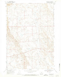
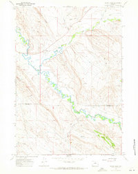
1967 Map of Worland SE
USGS Topo · Published 1971About this map
Sand Creek and its tributaries carve through this Wyoming landscape, revealing an era defined by resource extraction and livestock ranching. The 1967 field survey documents a network of infrastructure essential to the local economy, including numerous locations marked as Gas Well, Oil Well, and Drill Hole. These industrial points are scattered across the terrain alongside evidence of the region's agricultural roots, most notably the Tolman Shearing Pens located near the center of the sheet.
Find a feature on this map
13 named features on this map. Tap any name to fly to it.
Don’t see what you’re looking for? This feature index may not catch every label — zoom into the map to look around manually.
Map Details
Editions of this 1967 Worland SE Map
2 editions found
Other maps of this area

1955 · Sheridan
USGS Topo · 1:250,000

1955 · Arminto
USGS Topo · 1:250,000

1958 · Sheridan
USGS Topo · 1:250,000

1958 · Arminto
USGS Topo · 1:250,000

1962 · Sheridan
USGS Topo · 1:250,000

1962 · Arminto
USGS Topo · 1:250,000
1966 · Banjo Flats West
USGS Topo · 1:24,000

1966 · Cabin Fork
USGS Topo · 1:24,000
1966 · Banjo Flats East
USGS Topo · 1:24,000
1967 · Weintz Draw
USGS Topo · 1:24,000