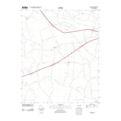
2010 Map of McDonald
USGS Topo · Published 2010About this map
McDonald and Raynham sit within a landscape defined by the drainage basins of the Lumber River and Back Swamp in Robeson County. This early 21st-century landscape shows a dense network of rural routes and family-named roads, such as Henry Berry Rd and Adams Rd, which reflect the long-standing agricultural and family heritage of the region. The map highlights the significant role of swamp systems like Horn Camp Swamp and Turkey Branch in shaping the local geography, where infrastructure often follows the higher ground between these wetlands.
Find a feature on this map
46 named features on this map. Tap any name to fly to it.
Don’t see what you’re looking for? This feature index may not catch every label — zoom into the map to look around manually.
Map Details
Editions of this 2010 McDonald Map
This is the sole edition of this map. No revisions or reprints were ever made.
Other maps of this area

1943 · Pages Mill
USGS Topo · 1:62,500

1953 · Florence
USGS Topo · 1:250,000

1954 · Florence
USGS Topo · 1:250,000

1960 · Dillon East
USGS Topo · 1:24,000

1962 · Fairmont
USGS Topo · 1:24,000

1962 · Gaddysville
USGS Topo · 1:24,000

1962 · Fair Bluff
USGS Topo · 1:62,500

1972 · Northwest Lumberton
USGS Topo · 1:24,000

1972 · Southwest Lumberton
USGS Topo · 1:24,000

1972 · Pembroke
USGS Topo · 1:24,000