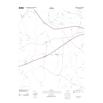
2013 Map of McDonald
USGS Topo · Published 2013About this map
The low-lying wetlands of Robeson County define the landscape surrounding McDonald, where the Lumber River and its associated drainages such as Back Swamp and Horn Camp Swamp navigate the coastal plain. In the early 21st century, the area shows a clear transition from traditional agricultural land use to more modern infrastructure, with the crossing of Interstate 95 and U.S. Route 301 near Raynham. Small-scale aviation is represented by Adams Airport, while local history is etched into the road names like Addison Tram Rd, referencing the region's historical timber and transport networks. The settlement at Elrod remains a distinct point in the northwest, situated near where Turkey Br feeds into the larger swamp systems. This survey provides a clear view of the hydraulic patterns and transport corridors that have shaped the rural communities in this portion of North Carolina.
Find a feature on this map
81 named features on this map. Tap any name to fly to it.
Don’t see what you’re looking for? This feature index may not catch every label — zoom into the map to look around manually.
Map Details
Editions of this 2013 McDonald Map
This is the sole edition of this map. No revisions or reprints were ever made.
Other maps of this area

1943 · Pages Mill
USGS Topo · 1:62,500

1953 · Florence
USGS Topo · 1:250,000

1954 · Florence
USGS Topo · 1:250,000

1960 · Dillon East
USGS Topo · 1:24,000

1962 · Fairmont
USGS Topo · 1:24,000

1962 · Gaddysville
USGS Topo · 1:24,000

1962 · Fair Bluff
USGS Topo · 1:62,500

1972 · Northwest Lumberton
USGS Topo · 1:24,000

1972 · Southwest Lumberton
USGS Topo · 1:24,000

1972 · Pembroke
USGS Topo · 1:24,000