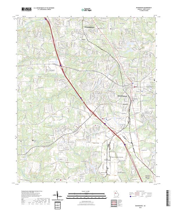
2024 Map of McDonough
USGS Topo · Published 2024About this map
McDonough serves as the central hub of this contemporary Georgia landscape, where the Henry County Courthouse marks the historic seat of local governance. The area shows significant development along the I-75 and Ga 42 corridors, connecting the major settlements of Stockbridge, Flippen, and Locust Grove. Genealogists will find numerous burial sites throughout the quadrangle, including the McDonough Memorial Cem, Akins Cem, and the Westmoreland Cem near the western edge.
Find a feature on this map
43 named features on this map. Tap any name to fly to it.
Don’t see what you’re looking for? This feature index may not catch every label — zoom into the map to look around manually.
Map Details
Editions of this 2024 McDonough Map
This is the sole edition of this map. No revisions or reprints were ever made.
Other maps of this area

1888 · Atlanta
USGS Topo · 1:125,000

1890 · Atlanta
USGS Topo · 1:125,000

1892 · Atlanta
USGS Topo · 1:125,000

1895 · Atlanta
USGS Topo · 1:125,000

1953 · Atlanta
USGS Topo · 1:250,000

1954 · Jonesboro
USGS Topo · 1:24,000

1957 · Atlanta
USGS Topo · 1:250,000

1958 · Atlanta
USGS Topo · 1:250,000

1964 · Luella
USGS Topo · 1:24,000
1964 · Mc Donough
USGS Topo · 1:24,000