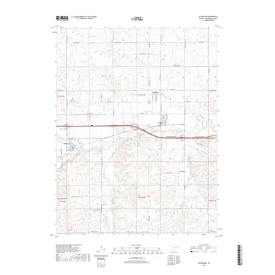
2018 Map of McFarland
USGS Topo · Published 2018About this map
Mill Creek winds through the central corridor of this Wabaunsee County landscape, serving as a primary drainage for numerous tributaries like Kuenzli Cr and Snokomo Cr. The settlement of McFarland occupies a strategic bend in the creek, defined by the infrastructure of the Union Pacific railroad and a grid including Wheeler Ave and 1st Ave. This area shows a transition from the structured town sites to the rolling terrain of Clapboard Canyon and the northern reaches of the Flint Hills. Local history is anchored by sites such as Newbury and Paxico, alongside well-documented burial grounds like McFarland Cem and Bethlehem Cem. The road network, with names like Strowigs Mill Rd and Plowboy Rd, suggests the agricultural roots and rural industry that have shaped this portion of the Kansas interior. Small waterways such as Mulberry Cr and Turkey Cr drain the northern sections, reinforcing the region's character as a network of creek valleys and prairie ridges.
Find a feature on this map
59 named features on this map. Tap any name to fly to it.
Don’t see what you’re looking for? This feature index may not catch every label — zoom into the map to look around manually.
Map Details
Editions of this 2018 McFarland Map
This is the sole edition of this map. No revisions or reprints were ever made.
Other maps of this area

1885 · Eskridge
USGS Topo · 1:125,000

1889 · Wamego
USGS Topo · 1:125,000

1889 · Eskridge
USGS Topo · 1:125,000

1894 · Eskridge
USGS Topo · 1:125,000

1894 · Wamego
USGS Topo · 1:125,000

1953 · Wamego
USGS Topo · 1:24,000

1953 · Maple Hill
USGS Topo · 1:24,000

1953 · Belvue
USGS Topo · 1:24,000

1953 · St Marys
USGS Topo · 1:24,000

1954 · Alma
USGS Topo · 1:24,000