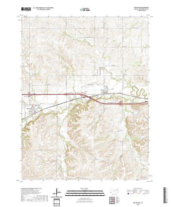
2022 Map of McFarland
USGS Topo · Published 2022About this map
McFarland and Paxico anchor this section of Wabaunsee County, where the landscape is defined by the winding course of Mill Creek and its many tributaries. The area exhibits a classic Midwestern section-line road grid, though the terrain often dictates more fluid paths for routes like Snokomo Rd and Fairfield Rd. The small settlement of Newbury sits to the north, part of a rural network that includes established local landmarks like the McFarland Cem and Bethlehem Cem.
Find a feature on this map
60 named features on this map. Tap any name to fly to it.
Don’t see what you’re looking for? This feature index may not catch every label — zoom into the map to look around manually.
Map Details
Editions of this 2022 McFarland Map
This is the sole edition of this map. No revisions or reprints were ever made.
Other maps of this area

1885 · Eskridge
USGS Topo · 1:125,000

1889 · Wamego
USGS Topo · 1:125,000

1889 · Eskridge
USGS Topo · 1:125,000

1894 · Eskridge
USGS Topo · 1:125,000

1894 · Wamego
USGS Topo · 1:125,000

1953 · Wamego
USGS Topo · 1:24,000

1953 · Maple Hill
USGS Topo · 1:24,000

1953 · Belvue
USGS Topo · 1:24,000

1953 · St Marys
USGS Topo · 1:24,000

1954 · Alma
USGS Topo · 1:24,000