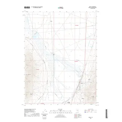
2018 Map of McGill
USGS Topo · Published 2018About this map
The high desert corridor of Steptoe Valley is defined by its industrial and ranching legacy in this 2018 survey. The town of McGill sits at the foot of the Duck Creek Range, its street grid including Smelter St and Hill St reflecting its history as a processing hub. Water management is central to the landscape, from the Durham McGill Ditch in the north to the Duck Cr Overflow Canal and Steptoe Slough. The vast network of springs, including Heusser Springs, Sheep Spring, and McGill Spring, supports the area's agricultural and mining activities. Between the heights of the Egan Range and the valley floor, small settlements like Glenn and Adverse appear alongside local routes such as Larson Ranch Rd and Dolomite Mine Rd, providing a detailed look at White Pine County's enduring geographic character.
Find a feature on this map
46 named features on this map. Tap any name to fly to it.
Don’t see what you’re looking for? This feature index may not catch every label — zoom into the map to look around manually.
Map Details
Editions of this 2018 McGill Map
This is the sole edition of this map. No revisions or reprints were ever made.
Other maps of this area

1952 · Ely
USGS Topo · 1:125,000

1956 · Ely
USGS Topo · 1:250,000

1958 · McGill
USGS Topo · 1:24,000

1958 · Ruth
USGS Topo · 1:24,000

1958 · East Ely
USGS Topo · 1:24,000

1958 · McGill
USGS Topo · 1:62,500

1959 · Ely
USGS Topo · 1:250,000

1959 · Schell Peaks
USGS Topo · 1:62,500

1963 · Ely
USGS Topo · 1:250,000

1981 · Duck Creek Valley
USGS Topo · 1:24,000