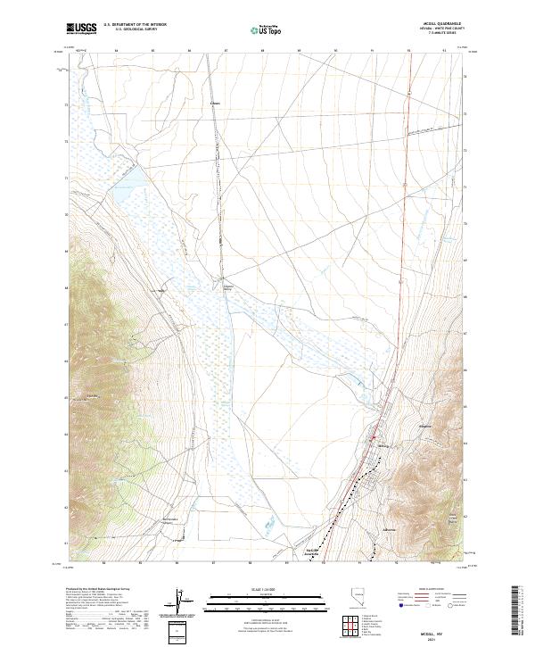
2021 Map of McGill
USGS Topo · Published 2021About this map
Steptoe Valley forms a broad basin between the Egan Range to the west and the Duck Creek Range to the east. This industrial and agricultural landscape is dominated by the town of McGill, where a grid of streets including Smelter St and Hill St hints at the community's mining heritage. The valley floor is heavily influenced by water management and industrial processing, evidenced by the extensive Steptoe Slough and the Tailings Cr drainage system. North of the primary settlement, the land opens into ranching country around Glenn, supported by the Durham McGill Ditch and Bassett Lake. The map reveals a complex network of springs, such as Schoolhouse Spring and Heusser Springs, which have historically sustained life in this high-desert environment. Traces of historical transit are visible along Old Hwy 93 and numerous canyon access routes like Lusetti Canyon and Rattlesnake Canyon.
Find a feature on this map
47 named features on this map. Tap any name to fly to it.
Don’t see what you’re looking for? This feature index may not catch every label — zoom into the map to look around manually.
Map Details
Editions of this 2021 McGill Map
This is the sole edition of this map. No revisions or reprints were ever made.
Other maps of this area

1952 · Ely
USGS Topo · 1:125,000

1956 · Ely
USGS Topo · 1:250,000

1958 · McGill
USGS Topo · 1:24,000

1958 · Ruth
USGS Topo · 1:24,000

1958 · East Ely
USGS Topo · 1:24,000

1958 · McGill
USGS Topo · 1:62,500

1959 · Ely
USGS Topo · 1:250,000

1959 · Schell Peaks
USGS Topo · 1:62,500

1963 · Ely
USGS Topo · 1:250,000

1981 · Duck Creek Valley
USGS Topo · 1:24,000