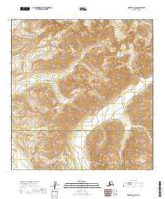
2019 Map of McGrath A-3 SW
USGS Topo · Published 2019About this map
The high peaks of the Alaska Range dominate this 2019 survey, defining a landscape of extreme vertical relief and glacial topography. This interior wilderness spans the boundary between the Yukon-Koyukuk Census Area and the Bethel Census Area, reflecting the modern administrative divisions of Alaska's unorganized borough. The North Fork Big River serves as the primary drainage for the area, its course winding through deep valleys shaped by tectonic and glacial forces. Because there are no roads or settlements on this map, the topography itself reveals the difficulty of access to these high-altitude ranges, where contour lines tightly cluster around unnamed summits and ridges that feed into the larger Kuskokwim River watershed.
Find a feature on this map
11 named features on this map. Tap any name to fly to it.
Don’t see what you’re looking for? This feature index may not catch every label — zoom into the map to look around manually.
Map Details
Editions of this 2019 McGrath A-3 SW Map
This is the sole edition of this map. No revisions or reprints were ever made.
Other maps of this area

1949 · McGrath
USGS Topo · 1:250,000

1950 · McGrath
USGS Topo · 1:250,000

1951 · Lime Hills
USGS Topo · 1:250,000

1954 · McGrath A-4
USGS Topo · 1:63,360

1954 · Lime Hills D-5
USGS Topo · 1:63,360

1958 · McGrath A-3
USGS Topo · 1:63,360
1958 · Lime Hills D-4
USGS Topo · 1:63,360

1958 · McGrath
USGS Topo · 1:250,000

1958 · Lime Hills
USGS Topo · 1:250,000
2019 · Lime Hills D-5 NE
USGS Topo · 1:25,000