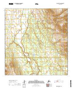
2019 Map of McGrath A-4 SE
USGS Topo · Published 2019About this map
Big River dominates this interior Alaskan landscape, winding through a vast corridor of wetlands and varying elevations at the boundary of two administrative regions. This 2019 survey documents the transition between the Yukon-Koyukuk Census Area and the Bethel Census Area, a remote area defined by its natural drainage patterns rather than human settlement. The absence of roads or established towns underscores the wilderness character of the region, where the river serves as the primary geographical marker. Researchers and cartographers can examine the intricate contour lines and township grids, such as t23n r30w and t24n r29w, which provide a precise framework for this uninhabited stretch of the Alaskan interior.
Find a feature on this map
8 named features on this map. Tap any name to fly to it.
Don’t see what you’re looking for? This feature index may not catch every label — zoom into the map to look around manually.
Map Details
Editions of this 2019 McGrath A-4 SE Map
This is the sole edition of this map. No revisions or reprints were ever made.
Other maps of this area

1949 · McGrath
USGS Topo · 1:250,000

1950 · McGrath
USGS Topo · 1:250,000

1951 · Lime Hills
USGS Topo · 1:250,000

1954 · McGrath A-4
USGS Topo · 1:63,360

1954 · Lime Hills D-5
USGS Topo · 1:63,360

1958 · McGrath A-3
USGS Topo · 1:63,360
1958 · Lime Hills D-4
USGS Topo · 1:63,360

1958 · McGrath
USGS Topo · 1:250,000

1958 · Lime Hills
USGS Topo · 1:250,000
2019 · Lime Hills D-5 NE
USGS Topo · 1:25,000