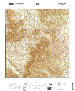
2019 Map of McGrath B-5 NW
USGS Topo · Published 2019About this map
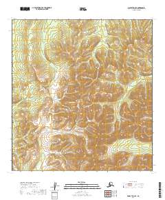
Selatna River meanders across this interior landscape of the Yukon-Koyukuk Census Area, defining the primary drainage for a region characterized by complex topographic relief. The land is organized by the Public Land Survey System into several townships including T27n R33w, T28n R33w, and T26n R33w. The terrain here is largely undeveloped, with no mapped roads, settlements, or structures appearing on this 2019 survey. The winding course of the river suggests a dynamic watershed where seasonal changes likely shift the shoreline against the surrounding hills. This map provides a clear record of the area's physical geography and boundary divisions in the early twenty-first century, useful for those studying the hydrologic patterns and land management of the Alaskan interior.
Find a feature on this map
10 named features on this map. Tap any name to fly to it.
Don’t see what you’re looking for? This feature index may not catch every label — zoom into the map to look around manually.
Map Details
Editions of this 2019 McGrath B-5 NW Map
This is the sole edition of this map. No revisions or reprints were ever made.
Other maps of this area

1949 · McGrath
USGS Topo · 1:250,000

1950 · McGrath
USGS Topo · 1:250,000

1954 · McGrath B-6
USGS Topo · 1:63,360

1954 · McGrath C-6
USGS Topo · 1:63,360

1954 · McGrath B-5
USGS Topo · 1:63,360
1955 · McGrath C-5
USGS Topo · 1:63,360

1958 · McGrath
USGS Topo · 1:250,000
2019 · McGrath C-5 SW
USGS Topo · 1:25,000
2019 · McGrath C-6 SE
USGS Topo · 1:25,000
2019 · McGrath B-6 SE
USGS Topo · 1:25,000