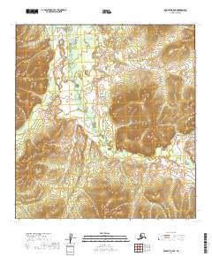
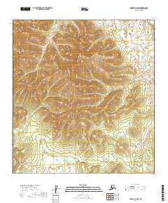
2019 Map of McGrath B-6 NE
USGS Topo · Published 2019About this map
The Selatna River and its tributary, the First Fork Selatna River, dominate this interior Alaska landscape within the Yukon-Koyukuk Census Area. The terrain is characterized by the complex meandering of these water bodies through low-lying valley floors, framed by significant topographical elevations in the eastern and western portions of the quadrangle. As captured in this 2019 data, the drainage patterns of the First Fork Selatna River reveal a dynamic hydraulic environment where the river channels shift across the basin. This USGS survey highlights the vast, uninhabited character of the region, emphasizing the natural watercourses that serve as the primary landmarks in an area otherwise defined only by the cadastral markers of the Public Land Survey System, such as t27n r34w and t28n r35w.
Find a feature on this map
8 named features on this map. Tap any name to fly to it.
Don’t see what you’re looking for? This feature index may not catch every label — zoom into the map to look around manually.
Map Details
Editions of this 2019 McGrath B-6 NE Map
This is the sole edition of this map. No revisions or reprints were ever made.
Other maps of this area

1949 · McGrath
USGS Topo · 1:250,000

1950 · McGrath
USGS Topo · 1:250,000

1954 · McGrath B-6
USGS Topo · 1:63,360

1954 · McGrath C-6
USGS Topo · 1:63,360

1954 · McGrath B-5
USGS Topo · 1:63,360
1955 · McGrath C-5
USGS Topo · 1:63,360

1958 · McGrath
USGS Topo · 1:250,000
2019 · McGrath B-6 SW
USGS Topo · 1:25,000
2019 · McGrath C-6 SW
USGS Topo · 1:25,000
2019 · McGrath C-5 SW
USGS Topo · 1:25,000