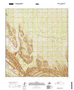
2019 Map of McGrath C-1 NW
USGS Topo · Published 2019About this map
Big Salmon Fork winds through this interior Alaskan landscape, serving as the dominant geographic feature across a series of township and range divisions. The terrain is defined by the complex drainage patterns feeding into this water body, which cuts a path through the wilderness of the Yukon-Koyukuk region. This 2019 survey by the U.S. Geological Survey provides a clear view of the unoccupied backcountry, where the absence of roads or permanent settlements highlights the isolation of the northern interior. The map focuses on the natural topography and the legal boundaries of the public land survey system, illustrating the vast scale of the Alaskan river systems before they reach more established trading or mining hubs.
Find a feature on this map
10 named features on this map. Tap any name to fly to it.
Don’t see what you’re looking for? This feature index may not catch every label — zoom into the map to look around manually.
Map Details
Editions of this 2019 McGrath C-1 NW Map
This is the sole edition of this map. No revisions or reprints were ever made.
Other maps of this area

1949 · McGrath
USGS Topo · 1:250,000

1950 · McGrath
USGS Topo · 1:250,000

1958 · McGrath D-2
USGS Topo · 1:63,360

1958 · McGrath C-1
USGS Topo · 1:63,360

1958 · McGrath C-2
USGS Topo · 1:63,360

1958 · McGrath D-1
USGS Topo · 1:63,360

1958 · McGrath
USGS Topo · 1:250,000
2017 · McGrath C-1 NE
USGS Topo · 1:25,000
2019 · McGrath D-2 SE
USGS Topo · 1:25,000

2019 · McGrath D-1 SW
USGS Topo · 1:25,000