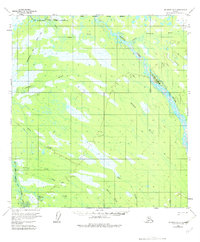
1954 Map of McGrath D-3
USGS Topo · Published 1983About this map
The Iditarod Trail and a series of Winter Trails cross this interior landscape, marking the essential transportation routes through the Alaskan wilderness in the mid-1950s. This region is defined by an intricate network of waterways, dominated by the South Fork Kuskokwim River and its numerous tributaries. The terrain is characterized by low-lying wetlands and complex drainage patterns, where the Salmon River and Little Tonzona River wind through the Seward Meridian. Small creeks like Bear Creek, Sullivan Creek, and Lined Creek create a dense web of water across the land. The presence of the Nikolai Corporate Boundary in the northern portion indicates the proximity of established human activity near these river systems, where seasonal trails were vital for travel and logistics before modern road development.
Find a feature on this map
12 named features on this map. Tap any name to fly to it.
Don’t see what you’re looking for? This feature index may not catch every label — zoom into the map to look around manually.
Map Details
Editions of this 1954 McGrath D-3 Map
2 editions found
Other maps of this area

1949 · McGrath
USGS Topo · 1:250,000

1950 · Medfra
USGS Topo · 1:250,000

1950 · McGrath
USGS Topo · 1:250,000

1953 · McGrath C-4
USGS Topo · 1:63,360

1953 · McGrath D-4
USGS Topo · 1:63,360

1954 · McGrath D-3
USGS Topo · 1:63,360

1954 · McGrath C-3
USGS Topo · 1:63,360

1954 · Medfra A-3
USGS Topo · 1:63,360

1958 · McGrath D-2
USGS Topo · 1:63,360

1958 · Medfra A-2
USGS Topo · 1:63,360