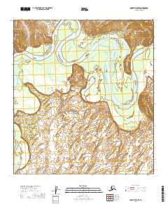
2019 Map of McGrath D-5 NW
USGS Topo · Published 2019About this map
McGrath occupies a prominent position on the western bank of the Kuskokwim River, where the landscape transitions into a complex network of wetlands and shifting river channels. The topography is dominated by the meandering river, which forms significant features such as Stewart Bend to the east and Smittys Lake near the center of the quadrangle. Local transportation infrastructure is concentrated around the settlement, branching out through a series of named routes including Cranberry Ridge Road and the Airstrip Perimeter Road. Further out, the Vanderpool Road and the Harris Trail suggest the essential overland connections required in this interior Alaska environment. The map provides a clear picture of how human settlement in this region is tightly bound to the river's path and the few reliable road corridors extending into the surrounding terrain.
Find a feature on this map
16 named features on this map. Tap any name to fly to it.
Don’t see what you’re looking for? This feature index may not catch every label — zoom into the map to look around manually.
Map Details
Editions of this 2019 McGrath D-5 NW Map
This is the sole edition of this map. No revisions or reprints were ever made.
Other maps of this area

1949 · McGrath
USGS Topo · 1:250,000

1950 · Medfra
USGS Topo · 1:250,000

1950 · McGrath
USGS Topo · 1:250,000

1953 · McGrath D-5
USGS Topo · 1:63,360

1954 · Medfra A-6
USGS Topo · 1:63,360

1954 · McGrath D-6
USGS Topo · 1:63,360

1954 · Medfra A-5
USGS Topo · 1:63,360

1958 · McGrath
USGS Topo · 1:250,000

1959 · Medfra
USGS Topo · 1:250,000
2019 · McGrath D-6 NE
USGS Topo · 1:25,000