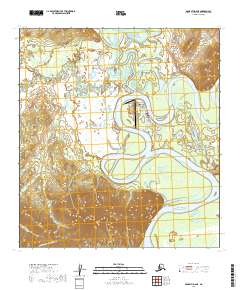
2019 Map of McGrath D-6 NE
USGS Topo · Published 2019About this map
McGrath serves as a critical interior hub where the Takotna River meets the sweeping curves of the Kuskokwim River. This 2019 survey captures the modern layout of the settlement, defined by its dependence on the McGrath Airport and a small network of local streets such as Chinana Avenue and Park Avenue. The landscape beyond the town center is dominated by complex river systems, including the Tatalina River and Candle Creek, which carve through the dense wetlands of the Yukon-Koyukuk Census Area.
Find a feature on this map
24 named features on this map. Tap any name to fly to it.
Don’t see what you’re looking for? This feature index may not catch every label — zoom into the map to look around manually.
Map Details
Editions of this 2019 McGrath D-6 NE Map
This is the sole edition of this map. No revisions or reprints were ever made.
Other maps of this area

1949 · McGrath
USGS Topo · 1:250,000

1950 · Medfra
USGS Topo · 1:250,000

1950 · McGrath
USGS Topo · 1:250,000

1953 · McGrath D-5
USGS Topo · 1:63,360

1954 · Medfra A-6
USGS Topo · 1:63,360

1954 · McGrath D-6
USGS Topo · 1:63,360

1954 · Medfra A-5
USGS Topo · 1:63,360

1958 · McGrath
USGS Topo · 1:250,000

1959 · Medfra
USGS Topo · 1:250,000
2019 · McGrath D-5 NW
USGS Topo · 1:25,000