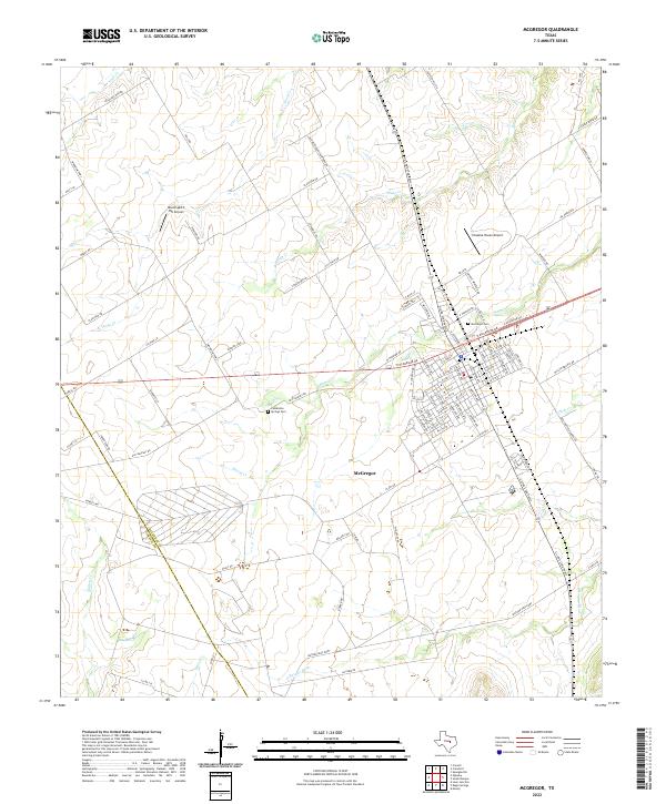
2022 Map of McGregor
USGS Topo · Published 2022About this map
McGregor sits at the heart of this Central Texas landscape, where the prairie begins its descent toward the S Bosque River valley. The map reveals a transition from the established street grid of the town to the surrounding agricultural lands and creek-cut terrain. Historically significant paths like the Old McGregor-Crawford Rd and Old Oglesby Rd cut across the landscape, following older travel corridors that predated modern highways.
Find a feature on this map
99 named features on this map. Tap any name to fly to it.
Don’t see what you’re looking for? This feature index may not catch every label — zoom into the map to look around manually.
Map Details
Editions of this 2022 McGregor Map
This is the sole edition of this map. No revisions or reprints were ever made.
Other maps of this area

1888 · Meridian
USGS Topo · 1:125,000

1892 · Temple
USGS Topo · 1:125,000

1892 · Waco
USGS Topo · 1:125,000

1894 · Meridian
USGS Topo · 1:125,000

1894 · Gatesville
USGS Topo · 1:125,000

1920 · Waco
USGS Topo · 1:125,000

1924 · Waco 3-d
USGS Topo · 1:48,000

1924 · Temple 2-C
USGS Topo · 1:48,000

1931 · Valley Mills
USGS Topo · 1:62,500

1931 · Mc Gregor
USGS Topo · 1:62,500