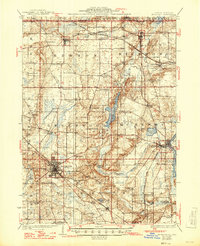
1926 Map of McHenry
USGS Topo · Published 1946About this map
The Wisconsin Illinois state line forms the northern boundary of this mid-century survey, where the rolling agricultural lands of McHenry County are defined by a dense network of local schools and established rail lines. The Chicago and Northwestern and Milwaukee and St Paul railroads intersect the landscape, connecting major hubs like Woodstock and McHenry to smaller outposts such as Hebron and Solen Mills.
Find a feature on this map
64 named features on this map. Tap any name to fly to it.
Don’t see what you’re looking for? This feature index may not catch every label — zoom into the map to look around manually.
Map Details
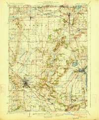
Editions of this 1926 McHenry Map
3 editions found

Other maps of this area

1893 · Delavan
USGS Topo · 1:62,500

1893 · Silver Lake
USGS Topo · 1:62,500

1893 · Geneva
USGS Topo · 1:62,500

1904 · Lake Geneva
USGS Topo · 1:62,500

1906 · Silver Lake
USGS Topo · 1:62,500

1906 · Lake Geneva
USGS Topo · 1:62,500

1920 · Grays Lake
USGS Topo · 1:62,500

1923 · Grays Lake
USGS Topo · 1:62,500

1923 · Barrington
USGS Topo · 1:62,500

1925 · Elgin
USGS Topo · 1:62,500