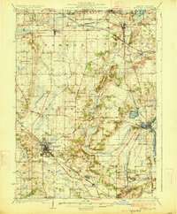
1926 Map of McHenry
USGS Topo · Published 1926About this map
The Chicago and Northwestern railroad network anchors this mid-1920s survey, dictating the development of northern Illinois agricultural hubs like Woodstock and McHenry. The landscape is defined by the Fox River and an intricate system of small water bodies such as Mc Cullom Lake and Lily Lake, surrounded by a dense grid of township roads. This era represents a peak for the rural school system, with nearly every section of the map featuring a named country schoolhouse, including the Silver Spring School and Keystone School.
Find a feature on this map
78 named features on this map. Tap any name to fly to it.
Don’t see what you’re looking for? This feature index may not catch every label — zoom into the map to look around manually.
Map Details
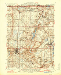
Editions of this 1926 McHenry Map
3 editions found

Other maps of this area

1893 · Delavan
USGS Topo · 1:62,500

1893 · Silver Lake
USGS Topo · 1:62,500

1893 · Geneva
USGS Topo · 1:62,500

1904 · Lake Geneva
USGS Topo · 1:62,500

1906 · Silver Lake
USGS Topo · 1:62,500

1906 · Lake Geneva
USGS Topo · 1:62,500

1920 · Grays Lake
USGS Topo · 1:62,500

1923 · Grays Lake
USGS Topo · 1:62,500

1923 · Barrington
USGS Topo · 1:62,500

1925 · Elgin
USGS Topo · 1:62,500