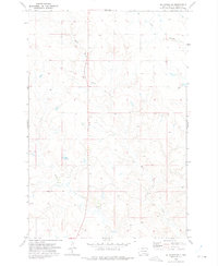
1972 Map of McIntosh SE
USGS Topo · Published 1975About this map
Standing Rock Indian Reservation lands comprise the entirety of this landscape, which is defined by the winding drainages of the Missouri River plateau in north-central South Dakota. Surveyed in the early 1970s, the terrain is shaped by the intermittent flows of White Shirt Creek, Hump Creek, and Stink Creek, which cut through the high plains. A lone Mine located near the center of the sheet indicates small-scale resource extraction amidst an otherwise open ranching or grazing landscape. The U.S. Geological Survey utilized aerial photography to capture fine details of the area, including field lines and fences that help define the land use patterns of the era. The presence of section lines and township markers like T. 22 N. provides a precise grid for those researching land tracts and genealogical records within the reservation boundaries.
Find a feature on this map
7 named features on this map. Tap any name to fly to it.
Don’t see what you’re looking for? This feature index may not catch every label — zoom into the map to look around manually.
Map Details
Editions of this 1972 McIntosh SE Map
This is the sole edition of this map. No revisions or reprints were ever made.
Other maps of this area

1953 · McIntosh
USGS Topo · 1:250,000

1956 · Black Horse NE
USGS Topo · 1:24,000

1956 · Black Horse
USGS Topo · 1:24,000

1956 · Miscol
USGS Topo · 1:24,000

1956 · Bullhead SW
USGS Topo · 1:24,000

1958 · McIntosh
USGS Topo · 1:250,000

1972 · McIntosh SW
USGS Topo · 1:24,000

1972 · Hump Butte
USGS Topo · 1:24,000

1972 · McIntosh
USGS Topo · 1:24,000
1972 · Tatanka Lake
USGS Topo · 1:24,000