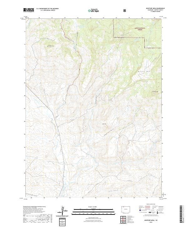
2022 Map of McInturf Mesa
USGS Topo · Published 2022About this map
McInturf Mesa and the surrounding high country of Moffat County dominate this landscape, where early 21st-century surveys show a territory defined by sophisticated water management and livestock grazing. The northeast corner is anchored by the Routt National Forest, while the lower elevations are crisscrossed by an extensive network of irrigation infrastructure including the Elkhorn Ditch, Cataract Ditch, and Tipton Ditch. These man-made channels divert water from natural flows like Fortification Cr and Little Bear Cr to sustain the arid range.
Find a feature on this map
33 named features on this map. Tap any name to fly to it.
Don’t see what you’re looking for? This feature index may not catch every label — zoom into the map to look around manually.
Map Details
Editions of this 2022 McInturf Mesa Map
This is the sole edition of this map. No revisions or reprints were ever made.
Other maps of this area

1916 · Craig
USGS Topo · 1:125,000

1923 · Elkhead Creek
USGS Topo · 1:62,500

1924 · Elkhead Creek
USGS Topo · 1:62,500

1954 · Craig
USGS Topo · 1:250,000

1957 · Craig
USGS Topo · 1:250,000

1958 · Craig
USGS Topo · 1:250,000

1960 · Craig
USGS Topo · 1:250,000

1962 · Craig
USGS Topo · 1:250,000

1964 · Craig
USGS Topo · 1:250,000

1965 · Craig
USGS Topo · 1:250,000