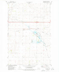
1975 Map of McKenzie
USGS Topo · Published 1977About this map
McKenzie sits at a historic transportation junction in central North Dakota, where the Burlington Northern line and a modern interstate highway corridor intersect. The landscape is defined by its transition from agricultural townships like Menoken and Mc Kenzie to the prairie wetland environments of the McKenzie Slough. Significant portions of the terrain are dedicated to conservation, including the State Game Management Area and the National Waterfowl Production Area, which protect the habitats surrounding Random Creek and Long Lake Creek. Traces of earlier development remain visible through the Old Railroad Grade and several scattered wells and a Gravel Pit. A regional Pipeline and a prominent Radio Tower reflect the utility infrastructure supporting Burleigh County during the mid-1970s.
Find a feature on this map
17 named features on this map. Tap any name to fly to it.
Don’t see what you’re looking for? This feature index may not catch every label — zoom into the map to look around manually.
Map Details
Editions of this 1975 McKenzie Map
2 editions found
Other maps of this area

1907 · Bismarck
USGS Topo · 1:125,000

1951 · Menoken
USGS Topo · 1:62,500

1951 · McKenzie
USGS Topo · 1:62,500

1954 · Bismarck
USGS Topo · 1:250,000

1958 · Bismarck
USGS Topo · 1:250,000

1971 · Huff NE
USGS Topo · 1:24,000

1971 · Moffit NW
USGS Topo · 1:24,000

1971 · Moffit
USGS Topo · 1:24,000

1975 · McKenzie
USGS Topo · 1:24,000

1975 · Sibley Butte
USGS Topo · 1:24,000